TRAVEL
Surrey’s Premier Lifestyle Magazine
Snow on the Skyline
Travel and food writer Nick Harman gets his motor running on the Skyline Drive, 105 miles of scenic beauty in Virginia, USA.
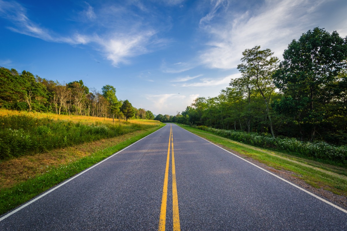
The Skyline Drive in Shenandoah National Park Virginia Photo copyright: Jon Bilous | 123rf.com


‘In the Blue Ridge Mountains of Virginia, on the trail of the lonesome pine’, I’ve had that tune in my head since catching sight of the eponymous mountains far across the Virginia countryside. I occasionally burst out singing it, drowning out the robotic American woman on my Satnav who keeps warning me of ‘impending severe winter storm at your location!’
I think she’s crazy; the sky is clear blue in all directions, even through the tinted glass of my rented car. The car’s basso profundo V8 rumble is reassuring too; even though it’s Japanese, it speaks of American confidence and excess as it gulps down fuel at a rate that would be alarming in any other country.
I’ve driven out from Washington DC to take a very special drive, the Skyline Drive. A road in the National Park Service’s Shenandoah National Park, it follows the crest, or ridge, of the Blue Ridge Mountains for around 105 miles. It has only three access points and it can be travelled north/south or south/north. I’ve chosen the latter so as to be back close to Washington and my flight home the next day should this winter storm become a reality, as the increasingly hysterical newsreaders on the radio seem convinced it will.
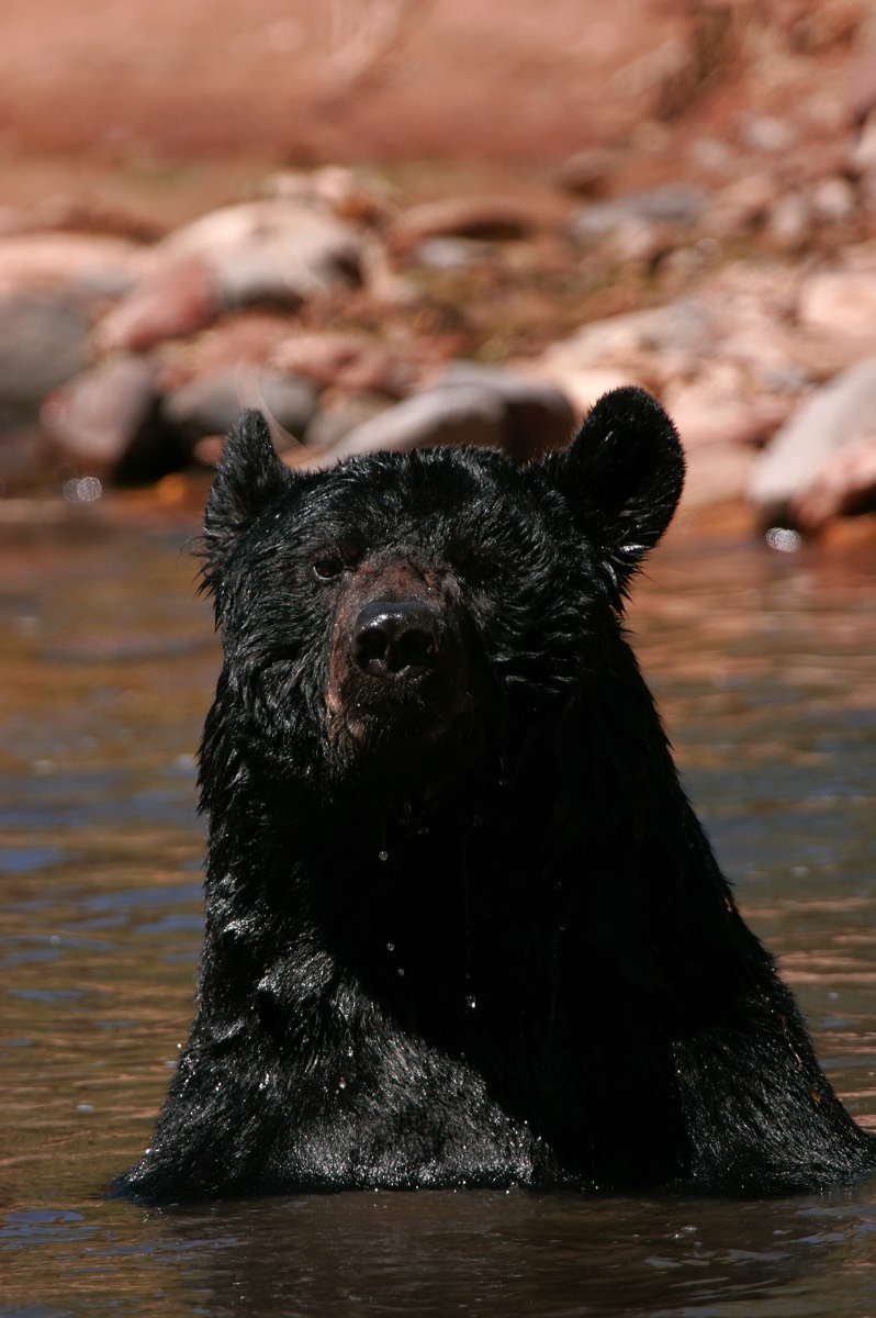
American black bear Photo copyright: donyanedomam | 123rf.com
The storm preys on my mind because I don’t want to be up on that ridge in a car manifestly unsuitable for anything but flat tarmac and dry weather. It’s a private road and it’s out of season so no one is around. Will they just find me in the spring with an enormous beard and the remains of foraged animals all around me? ‘Man appearing to be a hipster chef found in mountains, ignored all weather warnings,’ the news will read.
I swing off the I64 near Waynesboro and head for the Rockfish Gap, the most southerly entrance, stopping at a hiker and hunter store to get some vital supplies – chocolate and water. The burly owner in his ‘Hunting is Life’ baseball cap seems bemused that I am going up the Drive: it’s bitterly cold outside, despite the sun, and the season has nowhere near started yet.
“That’s the point,” I explain, “I want it all to myself”, but he’s gone back to counting ammunition, so I quietly leave.
My ears begin to pop as I rise higher and higher before suddenly arriving at the Drive entrance. Normally there are park rangers wearing those funny hats here eager to take the $25 entrance fee, but it’s eerily deserted. Rejoicing at the money saved, I floor the throttle and zoom up to 35mph.
Yes, 35mph because that’s the speed limit on the Drive and it is strictly enforced. You really don’t want to go any faster anyway because you’d miss the magnificent views, as well as endanger the deer, black bears and wild turkeys that often dash out of nowhere.
The trees at this time of year are mostly bare of leaves, except for some evergreen pines. Nearly all are coated in lichen that glows with a metallic blue colour, although the Blue Ridge Mountains get their name because from a distance the isoprene released into the atmosphere from the trees gives a blue haze.
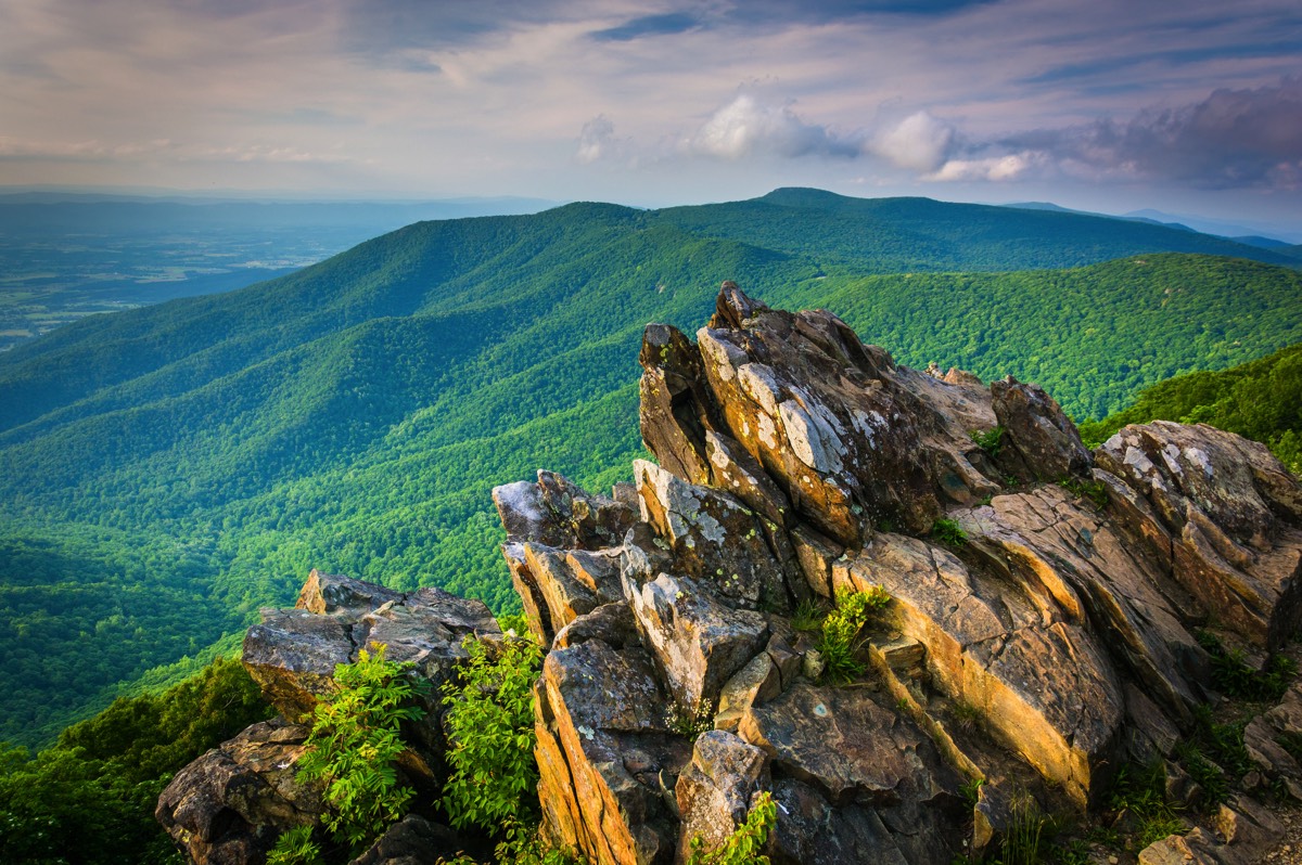
Blue Ridge Mountains from Hawksbill Summit, Shenandoah National Park, Virginia Photo copyright: appalachianviews | 123rf.com
I get tantalising glimpses east and west through the trees, but the road requires full attention as it winds around. Then comes the first legal stopping point, the McCormick Gap, and I can park and get out. The wind almost tears the car door off its hinges and I dive back in for more scarves and a hat. Then properly kitted out I head to the edge and the view from 2,455 feet.
Viewing spots like this, called Overlooks, number around seventy five along the way and alternate between east and west sides of the ridge with the occasional 360 view. The Shenandoah Valley is to the west and the rolling Piedmont is to the east.
This one looks west and is straightaway spectacular, an airplane view of countryside, rocks, rivers and roads. I stand amazed, while being buffeted by the wind, before moving on.
In season, the Drive isn’t just for driving, there are spots where it is possible to park up and walk to viewpoints unreachable by car. Some people I notice are doing it today, unless the cars are all that remain of previous foolhardy visitors. Off the Drive are places to see: powerful, impressive waterfalls as well as the mpgrounds, eateries and visitor centres that are dotted along its length On the west side of the road are mile markers, counting down north from 105. It helps orient with maps that show landmarks and things to do and see. And while the best time to drive the Drive is autumn when the leaf colours of the spruce and firs, oak and pine forests and mixed hardwood trees are stupendous, out of season like this means avoiding what can be very heavy numbers of cars and people.
I fall into a dreamy rhythm, gently rolling around the curves looking left and right, nibbling my Snickers’ bars and stopping at every Overlook to get out. A sudden oncoming car is such a rare occurrence it startles me, but apart from that I could be the last man on earth.
Some leisurely hours later, the storm warnings are becoming persistent and passing a point called Bacon Hollow Overlook makes me rather hungry, so I leave the Drive midway at Swift Run Gap and descend to the small town of Stanardsville to find a burger and a cheap motel for the night. The next day I wake up to find the car buried under two feet of snow. The moral here is: always listen to your satnav.
essence info
Visit the Skyline Drive website to find out more: www.visitskylinedrive.orgThanks to www.capitalregionusa.co.uk
“To many who travel the Drive, the highway itself is a park, complete with numerous deer sightings along the way.”
National Geographic